
← PlanJam.comArchived blog, 2007–2008

Los Angeles Metro - PlanJam.com

From your screen to the scene

Category: Recreation

The Romance of Rocks: Bouldering in Joshua Tree
by Patricia Lamkin

Joshua Tree National ParkI love the idea of extreme rock climbing, but I don’t relish the thought of dangling on a thin nylon rope over a deadfall drop. If you’re like me, you’ll be happy to know there’s fun alternative. You’ll find it in Joshua Tree, and it’s a great day trip for a hiking date.

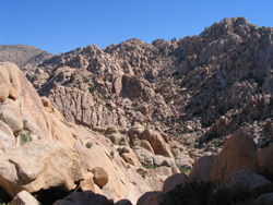
Only 140 miles east of Los Angeles, Joshua Tree National Park boasts three distinct eco-regions and six mountain ranges; but the most compelling feature of all lies to the west, in the giant piles of stone known as the Wonderland of Rocks.

It’s as if Salvador Dali sculpted these formations, which twist, bend and reach up in a surrealist fusion of monoliths, obelisks and spires. But it was millions of years of tectonic forces deep beneath the earth that formed these bizarre rocks, assisted by the unseen artistic hand of erosion. Luckily, the final masterpiece happens to be ideal for bouldering.

“Bouldering” is rock climber-ese for scrambling over, around and under piles of boulders and large rocks. It’s exhilarating and fun, but it requires strength, agility and commitment. In other words, if you and your friend are fit hikers, you’ll be fine.

Small-scale bouldering doesn’t require any special equipment, however, a good pair of leather gloves with the fingers cut off (biker gloves work great) and sturdy hiking shoes are an absolute must. They allow you to grip the rocks with Spiderman-like ease. Long sleeve shirts and blue jeans protect arms and legs from rocky scrapes. My more advanced bouldering buddy uses a thick, knotted rope of about 15 feet in length to help me out of crevices or up smooth walls. A rope and a buddy are just good sense - and more fun - to bring along. In summer bring plenty of water. In the winter just add plenty of layers and a warm hat. I always have some kind of head covering and sunscreen – temperatures here are 15 to 20 degrees cooler than Palm Springs, but there’s not a lot of shade!

If bouldering is not for you or your friend, the following trail hikes will give you the lay of the Wonderland without as much difficulty:

Fortynine Palms Oasis Trail is three miles round trip and of moderate difficulty. Over 50 fan palms make up this natural oasis with its pools of water. This palm oasis is one of five in the park.

Willow Hole Trail is an easy hike of seven miles round trip and features large water pools and willow trees. The trail begins at the Keys West Backcountry board, and goes through a modest gorge surrounded by tall boulders.

Boy Scout Trail is a scenic sixteen miles round trip, along the western edge of the Wonderland of Rocks. It is moderately difficult. You’ll find the trailhead at Keys West Backcountry board a half mile east of the Quail Springs picnic area. It’s not a bad idea to make this a shuttle hike, with a car parked at both ends.

To get to Joshua Tree from Los Angeles, take the I-10 East. Go North on the Twentynine Palms Highway to your selected destination.

Bouldering is an exciting alternative to extreme rock climbing that will get your blood pumping without the high risk. And while you’re up there, enjoy a romantic picnic for two on a cozy pancake of granite, and see who can find the craziest shapes in the rocks!

Photos by Randolph Scott
A Winter's Hike to Switzer Falls

by Patricia Lamkin

If you enjoy hiking, and you want an out of the way romantic adventure with a like-minded friend, you'll find it deep in Angeles National Forest on the rugged trails of Switzer's Falls.

Part of the Upper Arroyo Seco River Basin, Switzer's is located off the Angeles Crest Highway, seven miles north of interstate 210 above La Canada/Flintridge. The shady trail head features picnic tables, charcoal grills, and restrooms situated along a gurgling, stony creek. Switzer's offers beginner to advanced trails, sunny mountain views, cool wooded glades, and the highlight of it all: the falls!

Fall and winter hikes are some of the best in these mountains, especially after a swell of rain has replenished the creek. This is when the falls are the most spectacular (during the hottest droughts of summer they can dwindle down to a meager trickle.) But elevations here range from 1,200 to 10,064 feet, and that means it’s always much cooler than L.A. The views are spectacular, but wear warm layers under your coat and something over your ears. A cuddling companion is also highly recommended!

To get there take the 210 to the Angeles Crest Highway exit, (State Route 2), going north. To park you will need a National Forest Daily Adventure Pass (one per vehicle). These can be purchased for $5.00 at the Shell station on Angeles Crest Highway, near the junction for the 210. Continue north on Route 2 another seven miles up the mountain.

You'll pass a small ranger station on your right, (another place to buy an Adventure Pass), and shortly after you'll turn right at Mile Marker 34.2. This is the Switzer Picnic Area.

The hours posted at the gate are 6 am to 10 pm. Signs indicate that the gate is locked at 6:00 pm, but you will still be able to exit the park if you stay after dark. Drive down the curvy spur road to the parking area at the bottom. Take the footbridge over the creek, and you are on your way to the falls!

For the first leg, the trail follows the creek, and occasionally the trail will seem to end. When this happens, cross the creek and the trail picks up on the other side. The creek crossings are man-made but natural - large strategically placed rocks or logs.

Eventually the trail will seem to dead-end at a natural stone wall. Follow the signs to Switzer Falls, which points you to a railed footpath that zigzags up the rock face. Leaving the creek, take this to the top and continue on the trail. The trail will start going down into the canyon, and eventually will meet back up with the creek, which now becomes the trail. Follow the rocky creek-bed upstream until you reach the falls.

After your hike, check out the rustic and relaxed village of La Canada Flintridge. Warm up with a hot drink at Zeli's Coffee Bar at 639 Foothill Blvd. If you’re hungry, go up a block to the Dish restaurant. The cozy fire and all American cuisine make for a nice ending to a romantic winter's day.

A Romantic Hike to Griffith Observatory

by Patricia Lamkin

After months of closure due to last year’s devastating fires, Griffith Park is now happily open to the public. While there is still some evidence of fire damage, the greenery is coming back and Griffith’s hills are on the mend. The recent rainy season in L.A. is feeding that new growth, and with it comes the hope in 2008 for a full park recovery.

The largest municipal park and urban wilderness area in the United States, Griffith offers gorgeous views with California oak trees, wild sage, and 53 miles of hiking trails over chaparral covered hills.
While some of these trails are still restricted to hikers, there are still plenty of paths from which to choose.

An ideal hike this time of year takes you straight to the newly renovated Griffith Observatory. Advance reservations are no longer required, but parking is limited, so hiking there is ideal. From Western Avenue, enter Griffith Park off Los Feliz Blvd, turning left at the first traffic light onto Fern Dell Drive. Go north and park in the large parking lot on your left. From here cross the street and take a small foot-bridge over the Dell. The trailhead is behind the playground slide. You’ll see two trails. Take the one the left that slopes upward. It’s a nice wide trail, but it’s uphill, so offers a nice workout even at a leisurely pace. Whenever the trail splits bear right and keep hiking up until you reach the Observatory. The rangers at Griffith advise to please respect the closed/roped off paths as they are still in the recovery process, or are not legitimate trails.

Once you reach the Observatory, you might want to visit the Café at the End of the Universe for a nice hot cup of tea, and an incredible panoramic view that goes all the way to the Pacific. Then maybe take in a Planetarium show or film. For Griffith Observatory show schedules and hours, check out: http://www.griffithobs.org/vshuttle.html

Believe it or not, this time of year in LA, winter hikes can offer majestic views of foggy banks cascading over rocks, crisp clean air and no bugs. If you and your companion dress for the weather, you have a pretty romantic date in the making!

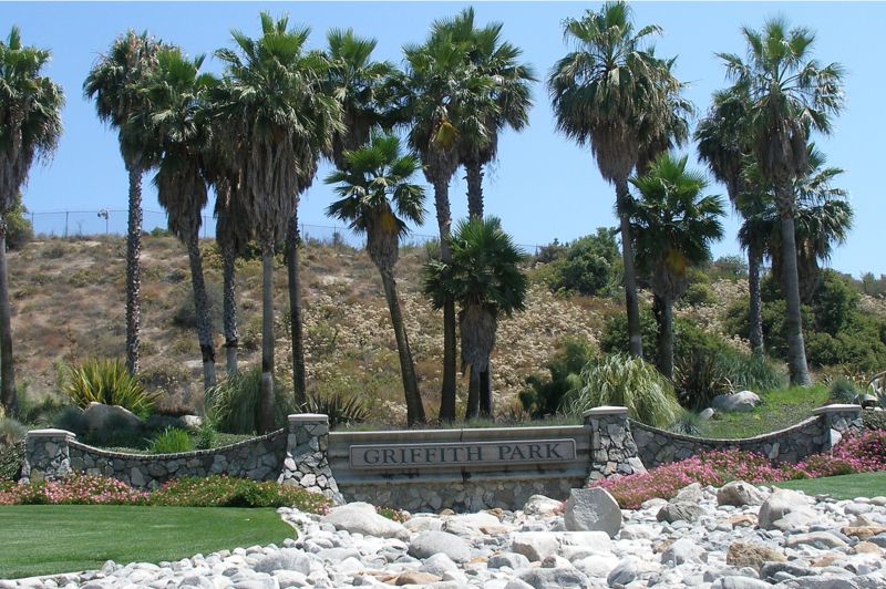
Griffith Park

by Ron

Griffith ParkSpanning across 4,107 acres, Griffith Park is the largest city park in the United States. In fact, the infamous Hollywood sign is actually located within the perimeters of Griffith Park.

There are numerous activities to engage in while visiting Griffith Park. The park is not only home to the Hollywood sign, but also houses the Gene Autry Museum of Western Heritage, Greek Theater, the Griffith Observatory, Los Angeles Zoo, the Travel Town Museum, the Griffith Park Merry-Go-Round, the Griffith Park Southern Railroad, and Pony Rides. Additionally, Griffith Park also features plentiful horseback riding, hiking trails, and bicycle rentals to enjoy the beautiful scenery first hand.

California’s rugged landscaping provides for a fantastic hiking experience. As you traverse through Griffith Park, you'll encounter many of the native California animals, such as quail, deer, and coyotes. Caution is advised however, since you may also cross paths with some rattlesnakes. In total, there are over 53 miles of trails and paths that are perfect for enjoying a short brisk walk, or a more strenuous hike. The trails are open from dawn until dusk and you can pick up trail maps at the Ranger Station.

In addition to hiking, many people enjoy horseback riding at Griffith Park. There are also pony rides available so families of all ages may enjoy the fun. There are specially designated trails for the riders, however, if riders choose to dismount, they must stay on the designated trails. Pony rides are available from Tuesday until Sunday between the hours of 10:00 A.M. until 4:00 P.M. There are also covered wagon rides that provide wonderful entertainment for young children. Whether you are on a date or enjoying the park with your family, you'll find plenty of activities to choose from while visiting Griffith Park.

Elysian Park

by Ron

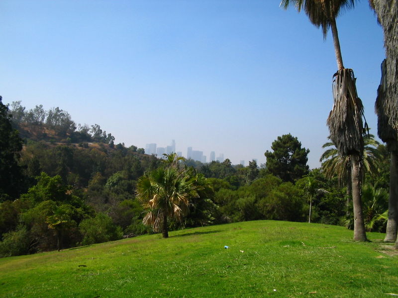
Elysian Park In Los AngelesThe second largest park in Los Angeles is the city's oldest, Elysian Park. Founded in 1781 by the Felipe de Neve, the Spanish California governor, the land originally encompassed over 17,000 acres. Today, the park is situated on 575 acres and is rich with historical sites, hiking trails, and national landmarks.

Since the park is so large, there are numerous activities to engage in. However, many find that the plentiful hiking trails offer some of the most beautiful scenic views throughout all of Los Angeles. There are plenty of picnic areas and barbecue pits in addition to the hiking and walking trails. Some of the features of Elysian Park include the Buena Vista Meadow Picnic Area, the Portola Trail Historical Monument, Solano Canyon where the community garden is located, and the Victory Memorial Grove, where the WWI Memorial is situated).

In addition to the hiking trails, the Elysian Park Therapeutic Recreation Center has outdoor seating and is designed to hold up to 300 people. There is a therapeutic program available for children and teens. There are also several barbecue pits as well as basketball courts and an indoor gym that has weights for working out.

The Montecillo De Leo Politi Park is commonly referred to as the Old Lodge and has many hiking trails as well. Located inside of Elysian Park, Montecillo De Leo Politi Park is open Monday through Friday from dawn to 3:00 P.M. Saturdays and Sundays, it is open from Dawn to Dusk. You'll find plenty of barbecue pits and picnic tables for your family events, but it is best to make reservations beforehand. They also have unlighted tennis courts. To make reservations for park use call: (213) 485-1310.

Hiking In Solstice Canyon

by Ron

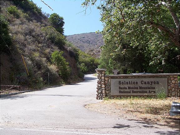
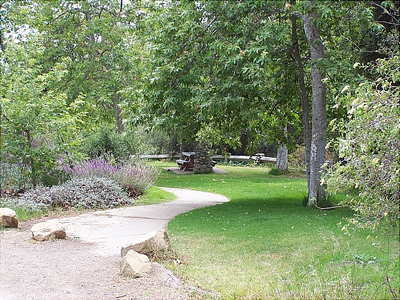
Entrance To Solstice CanyonNestled in the heart of Malibu, in the Santa Monica Mountains, lies a treasure waiting to be explored. The hiking trails in Solstice Canyon are the true star of Hollywood. With breathtaking scenic views of waterfalls, indigenous flora and fauna, a stream that flows year round, and numerous majestic Oaks, Alder, and Sycamore trees, the Solstice Canyon Park is great any time of year.

The canyons are a beautiful way to observe nature in all of her glory. It isn't uncommon to see animals such as deer, bobcats, quail, and mountain lions. There are over 45 mammal species that call the Solstice Canyon home, and over 380 bird species. The streams and lagoons are home to fish that are indigenous to the mountains, and are plentiful year round.

First opened as a public park in 1988, by the Santa Monica Mountains Conservancy, today they are under the management of the National Park Service. With five hiking trails that range from easy to strenuous, Solstice Canyon is revered as one of California's national treasures.

Getting Here

Getting to Solstice Canyon is quite simple. Travel along Pacific Coast Highway until you reach Corral Canyon Road. Turning on Corral Canyon Road, you'll see a large white fence with a gate off to the left side. Once you enter the park you will pay for parking, so inquire about direct routes to the trail you are looking for.

Solstice Canyon has five trails designated for hikers. Three of these trails are deemed easy and are great for the novice hiker or for those who just want to enjoy a leisurely scenic hike.

Dry Canyon Trail

Easy (1.2 miles): This trail is a great hike for the novice hiker. You'll enjoy viewing the 150-foot waterfall at the end of your journey. Be sure to bring plenty of water for your journey, and don't drink the water in streams, as they are not deemed suitable for drinking. When hiking, remember that you must always yield the right of way to horseback riders.

TRW Loop Trail

Easy (1.5 miles): The TRW Trail is a nice gentle hike. While on your journey you will pass through many oak trees. Keep an eye out for woodpeckers, the Peregrine Falcon, and the Red Tailed Hawk. There are also a number of snakes that are indigenous to the region, so it is best to avoid snakes, as the Southern Pacific Rattlesnake is venomous. Fortunately, it is the only venomous snake that lives in the Santa Monica Mountains.

Solstice Canyon Trail

Easy (2.1 miles): When hiking through the Solstice Canyon Trail be sure to keep a watchful eye out for the famed, Keller House. This is an excellent way to view some of Malibu's past history. If hiking with dogs, the dog must remain on a leash at all times, and they are only allowed on trails as well as access roads.

Rising Sun Trail

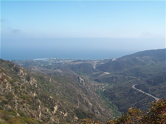
Moderate (3 miles): It is believed that this trail derives its name from a winery that was founded by Matthew Keller during the later 1800's. You'll enjoy the scenic views of the ocean while hiking along this trail.

Sostomo Trail/ Deer Valley Loop

Moderate/Strenuous (7 miles) This trail is the most strenuous and should be tackled by the seasoned hiker. This trail is beautiful and provides a breathtaking scenic view of the Pacific Ocean.

A Helicopter Tour of Los Angeles

by Ron

Los Angeles Helicopter TourWhen a romantic dinner just won’t cut it…
Looking for something totally spontaneous and out of the ordinary to surprise that special someone? Whether it’s your anniversary, birthday, or just another date - a helicopter tour of the city is a fantastic experience that’s sure to be a hit (assuming of course that your significant other isn't afraid of heights).

Los Angeles is home to about a half dozen helicopter charter companies that would be more than willing to help you plan that perfect evening. Packages vary from a simple 25-minute tour of popular Los Angeles landmarks and/or Pacific Coast to something a little more elaborate such as a limousine ride, tour, and dinner.

The cost is a little hefty so it’s not the most practical idea if you’re working with a budget. Prices vary based on the charter company but can expect to spend about $150/each for a 30-minute tour and upwards of $200/each for a 45-minute run. Add dinner and a limousine ride and you'll be in for a $1,000 evening.

Here are a few of the companies offering tours in Los Angeles (listed alphabetically):

Adventure Helicopter Tours
Departs From: Whiteman Airport - Pacoima
Reservations: 818-612-3676
Company Website

Briles To Fly Los Angeles
Departs From: Van Nuys Airport
Reservations: 877-863-5952
Company Website

Celebrity Helicopters
Departs From: Varies
Reservations: 877-999-2099
Company Website

HeliClass
Departs From: Van Nuys Airport
Reservations: 661-253-1437
Company Website

Will Rogers State Historic Park

by Ron

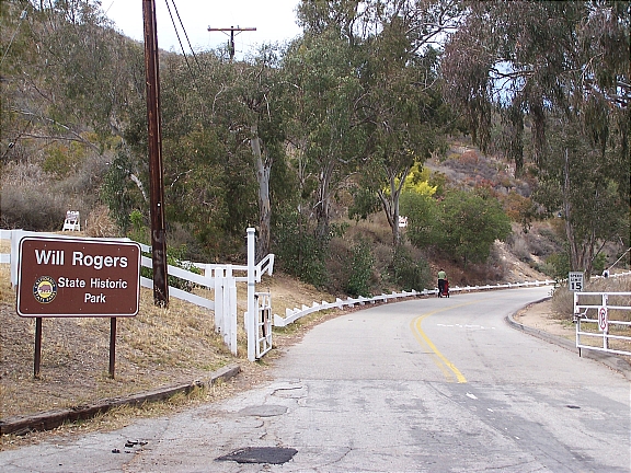
Will Rogers State Historic Park - EntranceLocated in the Pacific Palisades, Will Rogers State Historic Park is one of Los Angeles’s best kept secrets. One of the most popular and highest paid actors of his time, Will Rogers purchased this 186-acre property during the 1920’s as a retreat for his friends and family. An avid rider and horse fanatic, Will Rogers built an expansive ranch which included a 31-room ranch house, stable, corrals, riding ring, and a polo field. In 1935, Will Rogers was the victim of a tragic plane crash, and following his wife’s death in 1944, the ranch was converted into a State Park.

One of the most popular activities to enjoy at Will Rogers State Historic Park is hiking. Take the easy/moderate 3-mile trail loop up to Inspiration Point where you’ll be able to enjoy breathtaking views of downtown Los Angeles, Santa Monica, and the Pacific Coast. If you’re looking for something a little more challenging, head up along the Backbone Trail into the Santa Monica Mountain. The trail offers a fantastic opportunity for mountain biking, horseback riding (BYOH – Bring Your Own Horse), and hiking – leading you as far as Point Mugu State Park in Malibu.

Will Rogers State Park is also popular for picnicking – there is tons of green space available for you to set up and enjoy picnic (first picture below).

For something completely different, head up to the park on the weekends for an exciting polo match. The polo field (second picture below) is the only regulation size field in Los Angeles County; in fact, it’s the only polo field period. During the season (April through October), the Will Rogers Polo Club holds matches on Saturday – from 2pm to 5pm, and Sunday – from 10am to 1pm. The matches are absolutely free to the public, so if you’ve never seen a game of polo in person, make sure to come by and check it out.

Getting Here

Getting to the park is quite simple. Take Sunset Blvd westbound towards Pacific Palisades and make a right on Will Rogers State Park Rd. You’ll take the road for about half a mile until you reach the park entrance. Entrance to the park is free but there is a $7 fee for parking.

Piuma Lookout In Malibu: Part 2

by Ron

View From The Overlook The last overlook I covered along Piuma Rd in Malibu (Piuma Lookout: Part 1) was pretty easy to access and couldn’t be missed. The lookout had a couple picnic tables and a breathtaking panoramic view of the canyons. Now if you’re looking for something a little more secluded and want to get a glimpse of the Pacific Coastline, head a little further down Piuma Rd till you see a short trail that leads off the road (first picture below).

You can park your car along Piuma Rd (make sure you’re not actually on the road) and make your way up the hill. It’s a little steep and there are rocks so you’ll want to wear some comfortable shoes that you wouldn’t mind getting dirty. Although it may look difficult, it’s really not that bad getting up there…just be careful and watch your step.

Once you reach the top of the hill there will be a small dirt area where you can enjoy the view (second picture below). If you want to hang out there for a while, bring along a blanket and lay it out on the ground. Although you’re not trespassing and there are no signs prohibiting it, I can’t be certain that you’re allowed up there – so just keep that in mind before you go.

Notice: PlanJam is not responsible for any injuries and/or fines that may be incurred. If you decide to go up there…you do so at your own risk.

Temescal Gateway Park

by Ron

Temescal Gateway Park - Pacific PalisadesLocated in the Pacific Palisades, Temescal Gateway Park covers over 140-acres of terrain and is one of the most popular of the Santa Monica Mountain parks. The park offers ample opportunities for picnicking, panoramic views of the coastline, large grassy areas, and access several hiking trails that range from easy to moderate difficulty. You can also access additional hiking trails into Topanga State Park and Will Rogers State Historic Park.

Parking is available at the park entrance for $5 per day. The parking lot is a haven for parking enforcement so make sure that you follow all the rules. Also, make sure to watch your speed and come to a complete stop when necessary; the forest rangers are always on the prowl and they won’t hesitate to give you a citation. By the way, failure to come to a “complete” stop will run you about $100 (this comes from experience).

Alternatively, you can skip the parking fee and park along Temescal Canyon Rd or Sunset Blvd for free; just make sure to read the signs before heading up to the park. Also, if you’re coming here for the hike, make sure that you bring plenty of water along with you…there are no water fountains along the trails.

Getting Here

Getting to Temescal Gateway Park is really simple. If you’re taking PCH, turn onto Temescal Canyon Rd and head up about 1 mile until you reach Sunset Blvd…the park will be directly in front of you. If you’re taking the streets and are headed westbound along Sunset Blvd, you’ll make a right turn into the park at Temescal Canyon Rd.